


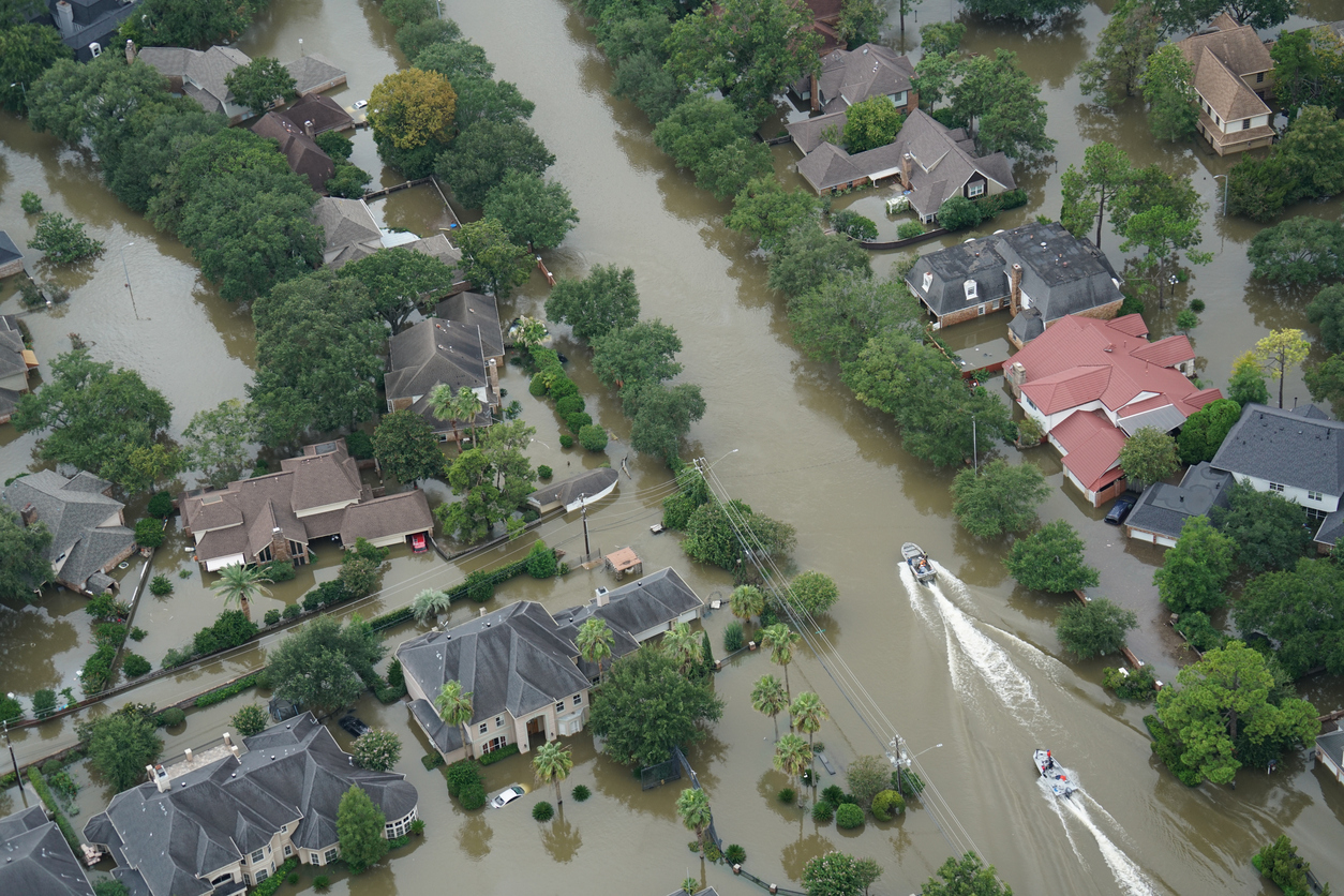
Then during a rainstorm in 2017, a half-foot of water filled her home, damaging cabinets, electrical wiring and causing mold. After she filed an insurance claim, she discovered her home had flooded repeatedly before. It was no longer eligible for flood insurance, rendering it virtually worthless.
“My life savings is in this house,” she said. “That would have been a deal breaker right there, knowing now the flood history.”
Ms. Gaker isn’t alone in finding it difficult to uncover a property’s flood history. In Florida and a number of other states, sellers have limited or no legal obligation to disclose if a property has flooded before. It is difficult for inspectors to see if a home is a flood risk unless they happen to visit at high tide or during a heavy rainstorm.
Rising sea levels are leading more home buyers to steer clear of the areas that are especially vulnerable. But determining which neighborhoods are the most at risk of flooding is proving to be a big challenge.
First Street Foundation, a nonprofit working in collaboration with academics, is creating a new database it says can better address the issue, but not everyone is convinced that it can solve all the complications of determining the flood risk to properties.
Federal flood maps, which outline flood zones, are designed to help set insurance premiums, but have a number of drawbacks as a source of information for would-be home buyers. They don’t take into account future sea-level rise or increased risk of more intense hurricanes.
Who's Really at Risk?
FEMA flood zone maps have become the de facto source of flood risk information for homeowners, even though many have not been updated in a decade.
Budget constraints have meant that large areas, mainly in the middle of the country, at risk of flooding from rivers and heavy rainfall aren’t mapped at all, according to a First Street analysis of FEMA data. That is a renewed concern to homeowners and policy makers after recent floods caused home and car damage in Oklahoma and Louisiana.
Homeowners may not see any of this information until they are at the closing table and it can be too late to walk away.
“We know the maps are fundamentally wrong,” said Matthew Eby, founder and executive director of First Street, which advocates for providing homeowners with more information about flooding and climate change. “The maps are out of date.”
David Maurstad, deputy associate administrator for insurance and mitigation at the Federal Emergency Management Agency, said the federal flood maps weren’t designed as a tool for homeowners to assess their risk of flooding but to determine whether homeowners were required to purchase flood insurance.
“That binary approach has had some unintended consequences,” he said. “People who are out of the high-risk areas don’t realize they need to take action.”
First Street is among a handful of organizations trying to improve flood disclosure. In collaboration with Columbia University, the Massachusetts Institute of Technology, the University of California at Berkeley and other institutions, it is putting together a comprehensive database on whether homes in the U.S. have previously flooded or are at risk of future flooding.
First Street and its partners use satellite imagery, high-water-mark data and other information to model whether homes would have been flooded. It combines this with FEMA data on flood claims that already exist but are difficult for ordinary homeowners to access.
Such information has long been available to large institutional owners of real estate and insurance companies, but it is far too costly for most individual homeowners to obtain. First Street’s database, which it expects to have up and running within a year, will be available, free of charge, for individual homeowners.
Mr. Maurstad said FEMA is working on making data about flooding more easily available and giving owners a more nuanced picture of whether their home is at risk. He welcomes efforts by First Street and others.
Still, some economists think these private databases bring problems of their own. While mapping flooding risk isn’t an exact science, just the suggestion of elevated flood risk can scare off buyers and devastate an owner’s ability to sell his or her home.
That is a concern for Skylar Olsen, a senior economist at Zillow Group Inc. who said the company is looking at providing flood risk information on its site but worries consumers may not understand the margin of error inherent to such information.
Scientists don’t agree on how much sea levels will rise in the coming decades, how much rising temperatures will affect the severity of storms and other unknowns.
“How do you represent that kind of number that can have a big impact on my willingness to buy this place, my ability to sell this place?” she said.
First Street said it is working with the Wharton Risk Management and Decision Processes Center at the University of Pennsylvania about how to communicate the information in a way that conveys its limitations.
“Knowing that a property is at risk is going to lower its value and that’s going to be upsetting. Hiding the risk isn’t going to be helping anyone, it’s just hiding the risk until later on,” said Carolyn Kousky, executive director of the Wharton center.